Extrapolating V S 30
Input Borehole Profile
Import Borehole Profiles
Q&A
Why do we need a extrapolated
How accurate does a extrapolated
What model is the extrapolation method of this website based on?
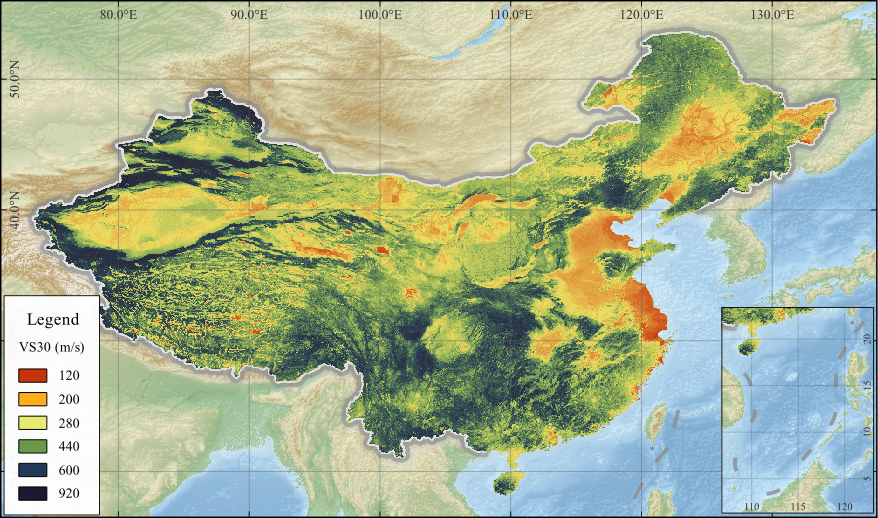
V S 30
The
Extent:Mainland China
Data type:GeoTIFF; csv
Resolution:30 arcsec
License type:CC BY

This work is licensed under a Creative Commons Attribution 4.0 International License.
Dataset
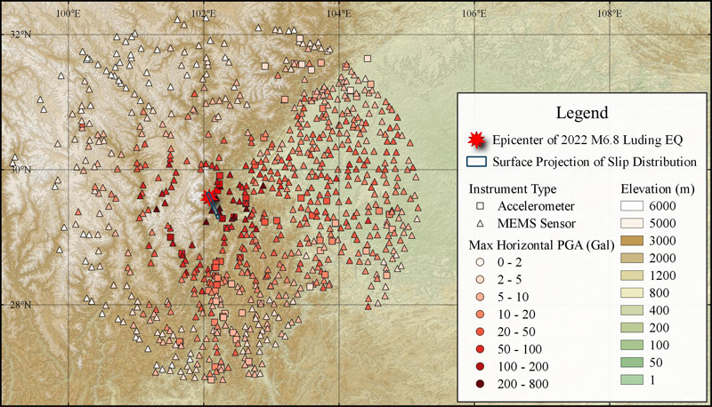
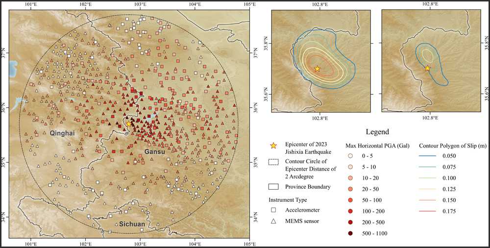
The Strong-Motion Dataset (PGA, PGV, and Site
Extent:300 km of the epicenter
Data type:Microsoft Excel
License type:CC BY-SA

This work is licensed under a Creative Commons Attribution-ShareAlike 4.0 International License.
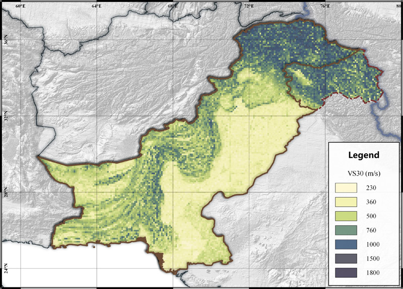
Extent:Pakistan and Kashmir
Data type:Microsoft Excel
Resolution:0.1 arcdegree
License type:CC BY-SA
This work is licensed under a Creative Commons Attribution-ShareAlike 4.0 International License.
Citation:Zhou J., L. Li, G. Y. Xu, C. L. Li, C. Wang, and X. Tian (2021). Evaluating Earthquake Hazard and Risk in Pakistan: Institute of Geophysics, CEA Seismic Risk Assessment for Countries along the Belt and Road Report, 2021-001, 80p.
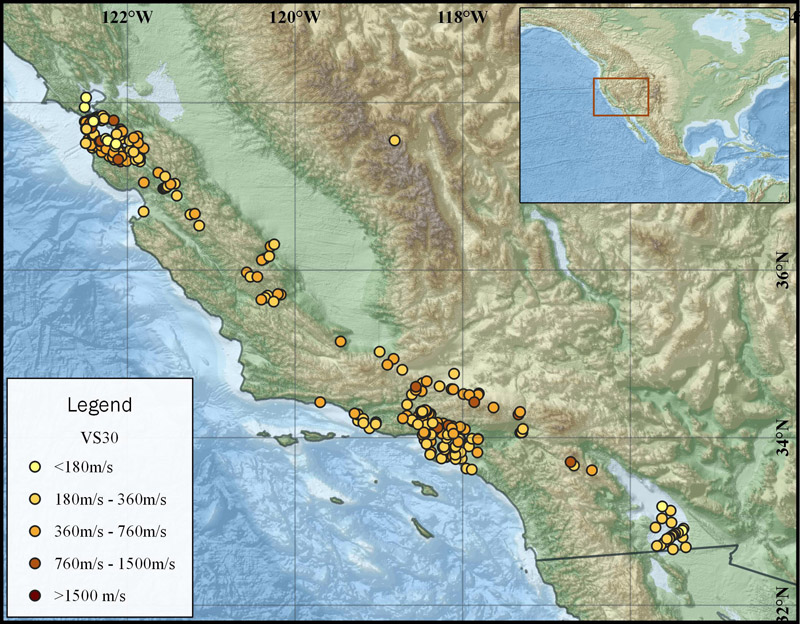
California
Extent:California, USA
Data type:Microsoft Excel
License type:CC BY
This work is licensed under a Creative Commons Attribution 4.0 International License.
Citation:Boore, D. M. (2003). A compendium of P- and S-wave velocities from surface-to-borehole logging: Summary and reanalysis of previously published data and analysis of unpublished data, U.S. Geol. Surv. Open-File Rept. 03-191, 13 pp.
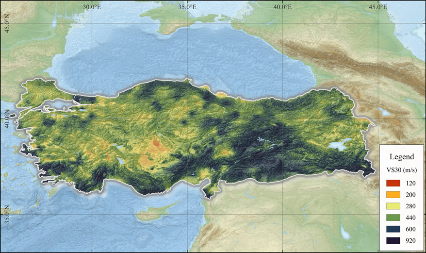
Extent:Turkey and Adjacent Area Related to the Feb. 2023 Turkey Earthquake Sequence
Data type:Microsoft Excel; jpg
License type:CC BY-SA
This work is licensed under a Creative Commons Attribution-ShareAlike 4.0 International License.
An Open Access Dataset for Strong-Motion Data (PGA, PGV, and Site
Extent:2 arcdegree (approximately 200 km) of the epicenter
Data type:Microsoft Excel
License type:CC BY
This work is licensed under a Creative Commons Attribution 4.0 International License.
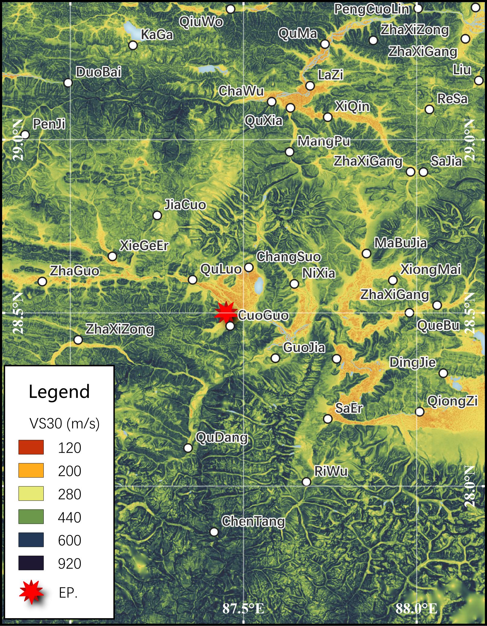
90 m Resolution
Extent:140 × 200 km; E86.8°– E88.2° N27.6° – N29.4°
Resolution:3 Arcsec (approximately 90 m)
Data type:CSV
License type:CC BY
This work is licensed under a Creative Commons Attribution 4.0 International License.
Historical Versions of
Extent:Mainland China
Resolution:30 arcsec
Data type:DBF
License type:CC BY
This work is licensed under a Creative Commons Attribution 4.0 International License.
